|
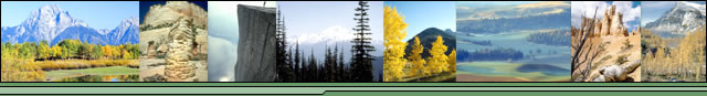
Penner Lake Loop, August2005
back to Pictures
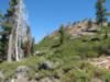
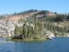
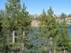
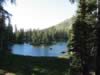
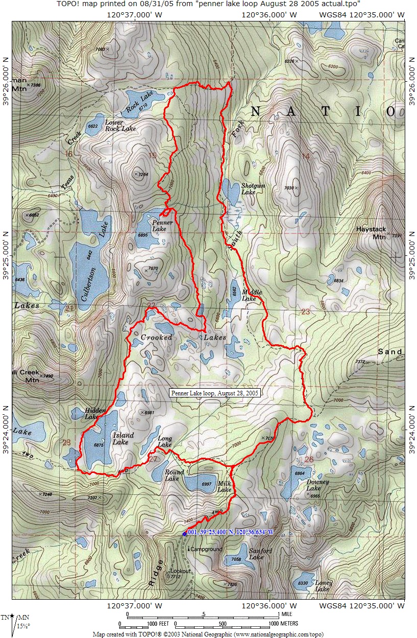
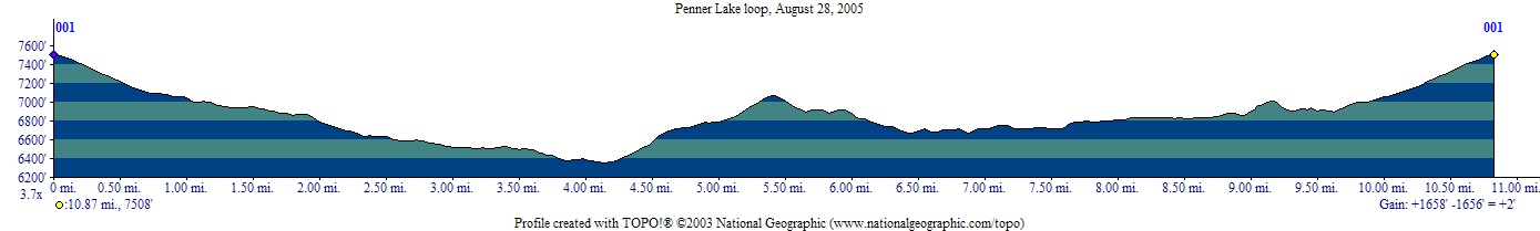
The Penner Lake hike was the most beautiful Sierra adventure of our summer 2005. This was easily achieved, as it was the only one. Jest aside, the hike from Grouse Ridge to Penner Lake, in a loop around the lakes of the region, is truly magnificent. The pristine Penner Lake lies at 6,895 feet, and is about 5.5 miles from Grouse Ridge via the trail along Shotgun Lake, or about 4 miles going around Island Lake. We did it as a loop, first going towards Shotgun Lake and then coming back by Island Lake. We walked via the Crooked Lakes trail rather than the direct way between Penner Lake and Island Lake, to add some variety to the adventure. This image shows the actual GPS route, and this one the actual elevation profile of the hike. As can be seen from the profile, it is not a daunting hike, with reasonable elevation change. Although the last quarter mile or so back up to Grouse Ridge is always a bummer (we've hiked here before...). The GPS generated route can be downloaded here, and then can be used to guide you on this beautiful hike. |
The map that we used was printed from the National Geographic TOPO! California 4.x version map software. Although a few discrepancies can be seen on the map between the marked trail and reality (as shown through our GPS generated route), the TOPO! State software is a truly indispensable tool, and should be standard-issue for any back country planning and hiking. It is part of the TOPO! family of products from National Geographic. The TOPO! California maps can be printed in any of five scales and for any area and size. What's more, they can be imported into a PDA/GPS combination device, such as the Garmin iQue, for live location tracking. Below are some other features of this great product: |
- TOPO! State is Both PC and Mac Compatible - It is the only topographic mapping software for Mac users, and the Mac version has been completely redesigned for Mac OS X.
- 3D Views and Fly-throughs - are now included in the TOPO! State series products. The tool is newly designed and improved with easy to use controls.
- Updated Streets - Current streets and roads are now included in TOPO! State, so you have the most up-to-date information.
- Live Map Update - You don't have to worry anymore about whether the latest USGS quad updates are included in the off-the-shelf version of TOPO! State. You can search and easily download new quads. This feature also updates the street layer when there is an update available, as well as provide software updates.
- There are a total of 28 National Geographic TOPO! State titles:
- TOPO! Alaska outdoor recreation topo mapping software
- TOPO! Arizona outdoor recreation topo mapping software
- TOPO! Arkansas, Louisiana & Mississippi outdoor recreation topo mapping software
- TOPO! California outdoor recreation topo mapping software
- TOPO! Colorado outdoor recreation topo mapping software
- TOPO! Georgia, Alabama & Florida outdoor recreation topo mapping software
- TOPO! Hawaii outdoor recreation topo mapping software
- TOPO! Idaho outdoor recreation topo mapping software
- TOPO! Kansas & Nebraska outdoor recreation topo mapping software
- TOPO! Michigan, Ohio & Indiana outdoor recreation topo mapping software
- TOPO! Mid-Atlantic (Delaware, Maryland, Virginia, District of Columbia, West Virginia) outdoor recreation topo mapping software
- TOPO! Minnesota & Iowa outdoor recreation topo mapping software
- TOPO! Missouri, Oklahoma & Arkansas outdoor recreation topo mapping software
- TOPO! Montana outdoor recreation topo mapping software
- TOPO! Nevada outdoor recreation topo mapping software
- TOPO! New England (Connecticut, Maine, Massachussetts, New Hampshire, Rhode Island, Vermont) outdoor recreation topo mapping software
- TOPO! New Mexico outdoor recreation topo mapping software
- TOPO! New York & New Jersey outdoor recreation topo mapping software
- TOPO! North Carolina & South Carolina outdoor recreation topo mapping software
- TOPO! North Dakota & South Dakota outdoor recreation topo mapping software
- TOPO! Oregon outdoor recreation topo mapping software
- TOPO! Pennsylvania & New Jersey outdoor recreation topo mapping software
- TOPO! Tennessee & Kentucky outdoor recreation topo mapping software
- TOPO! Texas outdoor recreation topo mapping software
- TOPO! Utah outdoor recreation topo mapping software
- TOPO! Washington outdoor recreation topo mapping software
- TOPO! Wisconsin, Illinois & Michigan's Upper Peninsula outdoor recreation topo mapping software
- TOPO! Wyoming outdoor recreation topo mapping software
|
A worthy alternative to the TOPO! State Series software is the DeLorme Topo North America 9.0 product. The DeLorme Topo North America 9.0 topographic map software features updated USGS topographic map and elevation data integrated with the most recent DeLorme street, trail, campground, and highway network. The newly-designed 3-D mapping engine produces lifelike views of your favourite terrain, allowing you to soar above rivers and lakes, ascend mountains, and explore new places - all from your computer. The DeLorme Topo North America 9.0 software exchanges waypoints and draw objects with most popular handheld GPS models, as well as Palm OS and Pocket PC PDAs with attached receivers. |
|
All of these are available from our map software on-line store. |
|
|


